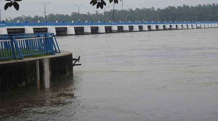
The water level of the Teesta River has begun to rise due to upstream hill torrents and several days of continuous rainfall. Authorities have opened all 44 gates of the barrage to control the water flow.
As of Saturday (May 31) at 10 PM, the Teesta`s water level was recorded at 51.86 meters (auto gauge), flowing just 30 centimeters below the danger level (danger level is 52.15 meters).
The Flood Forecasting and Warning Centre reported that the water level could rise by another 15 centimeters by 6 AM on Sunday (June 1). This would place the water just 15 centimeters below the danger level. However, after that, the water is likely to recede gradually. Upstream at India`s Gojoldoba point, the Teesta`s water level has increased by 120 centimeters in the last 24 hours.
On Friday (May 30) at 9 PM, the water level there was 110.30 meters. The water is currently beginning to decrease at that point. Simultaneously, at the Domohoni point, the water increased by 61 centimeters. At 9 PM, the water level at this point was 85.63 meters, which is 32 centimeters below the danger level.
The Bangladesh Water Development Board stated that there has been no significant rainfall in the Teesta basin, either domestically or upstream, in the last 24 hours.
Nurul Islam, a water surveyor at the Dalia Water Development Board, told the media that the Teesta`s water level has been rising for the past few days. Efforts are underway to control the water by opening all 44 gates of the barrage.