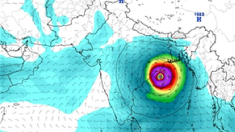
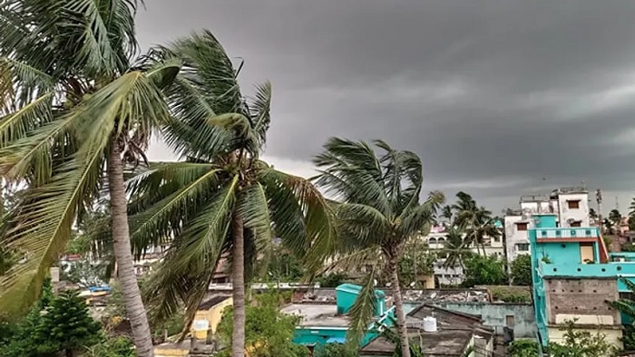
A powerful cyclonic storm, Cyclone Dana, is set to make landfall along the coasts of Bangladesh and India on Thursday (October 24), posing a significant threat to coastal communities.
The storm, which formed from a low-pressure system over the Bay of Bengal, is expected to bring strong winds and heavy rainfall, as reported by the India Meteorological Department (IMD). The cyclone could trigger dangerous storm surges, with some areas potentially facing surges up to 7 feet.
According to the IMD, the cyclonic circulation over the Andaman Sea intensified into a low-pressure area on Monday and is forecast to develop into a cyclonic storm by October 23.
Cyclone path and affected regions:
Cyclone Dana is projected to impact the coastal regions of Odisha and West Bengal in India before moving toward Bangladesh. In Bangladesh, the districts of Satkhira, Khulna, and Bagerhat are expected to experience the most significant effects, while in India, West Bengal`s Midnapore and South 24 Parganas are at risk.
Severe storm surges and warnings:
Meteorologists, using satellite data, have observed the increasing intensity of the storm, with wind speeds near 50 km/h as of Monday. Dana could escalate into a severe cyclone, bringing wind speeds of 110 to 120 km/h, which may lead to damage to buildings, crops, and infrastructure.
The biggest concern is the potential for a storm surge, especially if the cyclone makes landfall during high tide. Coastal regions such as Satkhira and Khulna could face surges as high as 7 to 8 feet above normal tidal levels, with other areas like Barguna and Patuakhali possibly seeing surges of up to 6 feet.
Preparations:
Authorities in both Bangladesh and India have urged residents in vulnerable areas to stay alert and prepare for possible evacuations. Emergency shelters are being prepared, and local officials are implementing precautionary measures to mitigate the effects of flooding and wind damage.
As the cyclone approaches, further updates will be provided, and residents are advised to closely monitor weather warnings and stay informed of evacuation plans.