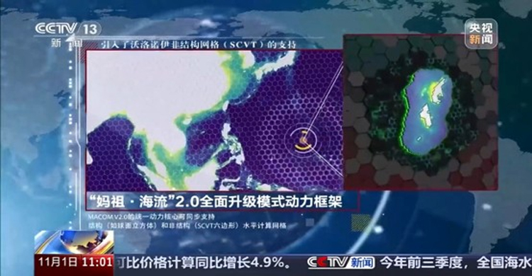
| Aiming to address critical requirements in deep-sea and polar expeditions, maritime safety, and navigational security, China’s National Marine Environmental Forecasting Center (NMEFC), under the Ministry of Natural Resources, on Sunday (November 1) released version 2.0 of its independently developed "Mazu" numerical ocean forecasting model. The upgraded version doubles the spatial resolution of its global forecasting system compared with its predecessor, achieving an accuracy down to 5 kilometers. In key priority maritime zones—including China`s coastal waters and the Western Pacific—the resolution has been refined to 1 kilometer. This enhanced fidelity permits significantly more precise modeling and analysis of seabed topography and hydrological dynamics across vital waters.At present, the holistic operational performance of the "Mazu" 2.0 model has attained an advanced international standard. In addition to safeguarding China`s maritime production and economic operations, the system is poised to play an active role in multilateral technical exchanges and marine environmental cooperation with Pacific Island countries. Source: Shishir, Alim, Akash | China Media Group (CMG)
|